Update: I made it to the summit.
I, like everyone else in Juneau, cannot believe the weather that we have had. Yesterday, Saturday, September 29, it was an amazingly beautiful autumn day. I intended to get an earlier start than I did, but still went for McGinnis at 9:20 am. I made it up in 4 hours, had an hour lunch, and took 4 hours to come down. Approximately 10 miles in 9 hours.
I don't know if this makes sense, but hiking up that mountain, the feeling of resentment started to percolate. It felt silly to have a feeling of resentment towards a mountain, but it was there. I was frustrated at how difficult it was and how tired I was. After 2 and a half hours, I knew that I still had a ways to go. And, I knew that what goes up, must come down. I wasn't going to get a ride down this time. And I started fantasizing how nice it would be to have a zipline zig-zag down the mountain from the top. But, the accomplishment of climbing a mountain is only 50%, the other half is getting back down.
On the way down, my knees turned quickly reminded me that I have not been doing what my physical therapist told me to do. For most people, going downhill is easier than up, but not for me. I move slowly while going down because I can't bend my right knee without it feeling like there's an ice pick jammed in it. Which causes me to put a lot of weight on my hiking poles and my left leg, which leads to cramping in my left calf. And because I was in a hurry to get up the mountain, I forgot to ingest any type of pain relief medicine and simultaneously forgot to put it in my first aid kit. The first hiker I ran in to while descending, I asked if they had any drugs to spare, and they happily handed me ibuprofen. It's my personal opinion that there is a special place in heaven for hikers that share pain relievers on the trail.
One thing I enjoy about hiking is the solitude, but also chatting with people. Maybe it was the weather, maybe it was the lack of tourists or the crisp air, but something about they day made everyone exceptionally friendly. At the top of the mountain while eating lunch, I chatted with two UAS students. Their knees are stronger than mine, so they ran down the mountain. And when I got down further, I ended up hiking the last 45 minutes of West Glacier/Ice Caves with another woman. I don't know if I'll see her again, but we had a great conversation, and the last bit of the hike just flew by.
Before I knew it, I was back to the car with enough energy to stretch haphazardly, have a glass of wine, and go to bed around 830.

Autumn colors on the mountain. About 2.5 hours in.

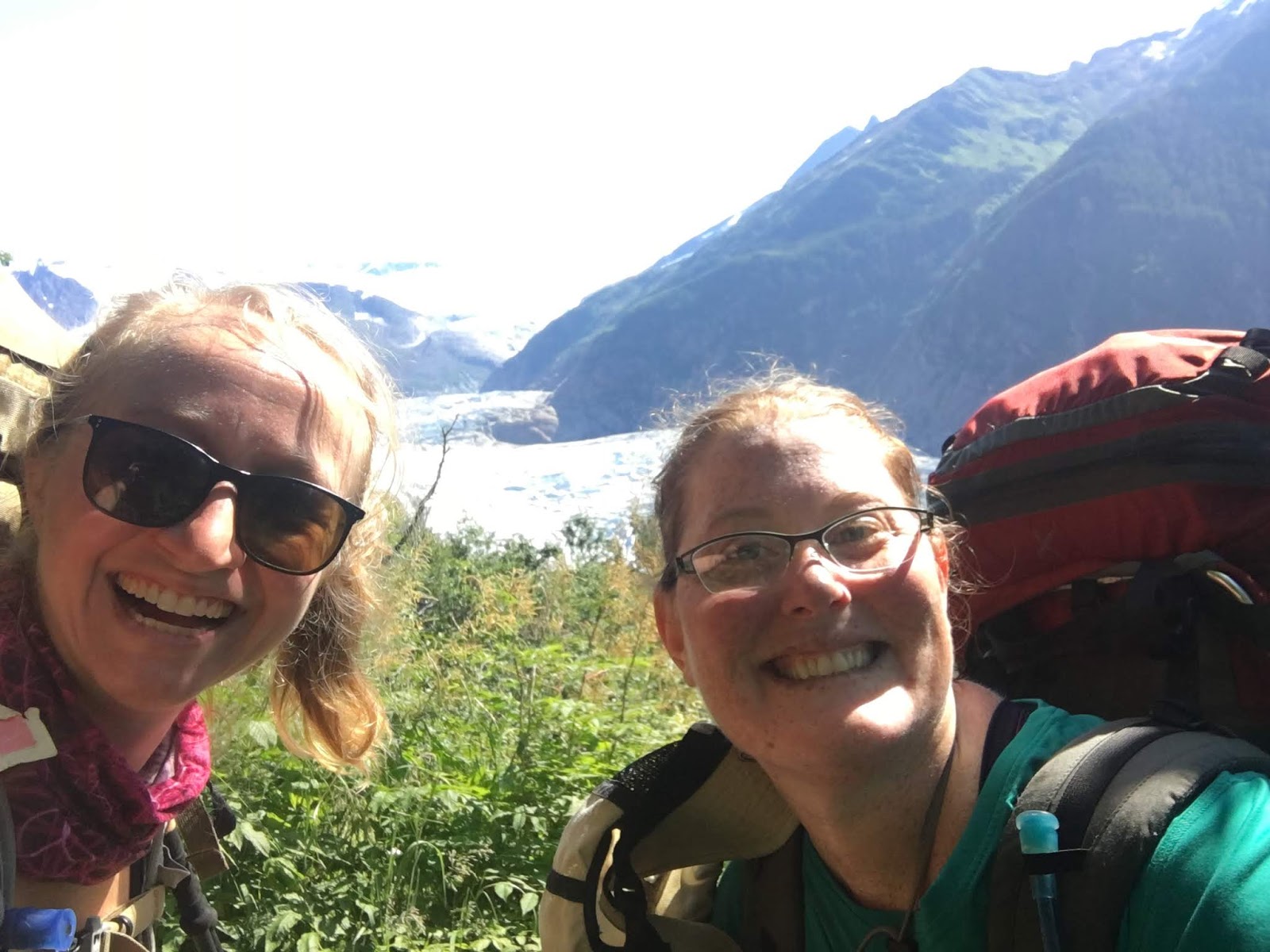
Mountain Top Selfie.

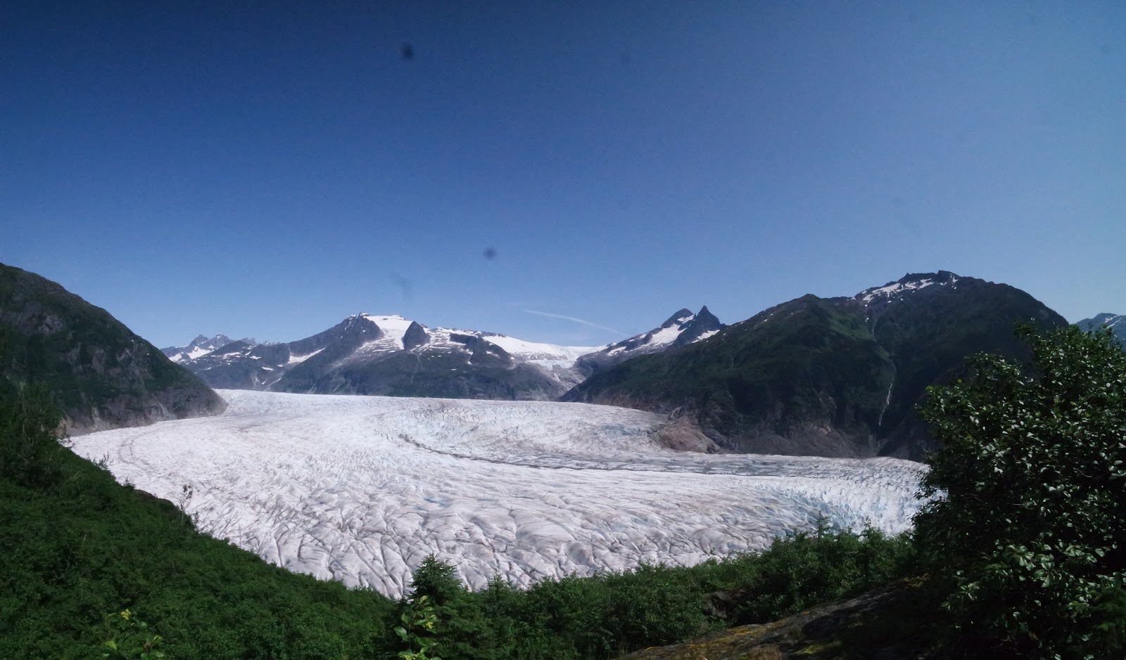
Looking to Stroller White and Mendenhall Glacier.

Looking down the McGinnis ridge to Mendenhall Valley and Auke Bay.
------------------------------------------------------------------------------------------------------------------------
The nice thing about doing something, like this project (The 30-hikes in my 30th year) that I've embarked on, is that I'm doing it for myself. I'm not being guilted, coerced, or pressured in to this project. It's a healthy hobby, and a good way to welcome in Middle Age (Yes, I'm calling 30 middle age). Another nice thing, is that you also get to set your own goals, and sometimes those goals change, and that's alright. There was one point when I started laughing out loud and to myself while on the Chilkoot Trail when I realized that in an age of instant gratification, it's kind of silly to start something, with the goal or final destination being the exact same place that you started: Skagway. I finally understood the whole "It's not the destination, it's the journey" saying.
Anyway, we decided that the weekend of July 21 would be when we schlepped up the side of McGinnis. There were 5 of us, a puppy, and far too much beer for an overnight trek.
Elevation: 4228
Ranking: Difficult
Length: I couldn't really tell you because I wasn't tracking it, and there doesn't seem to be a good website (from a cursory google search) that would tell you exactly how long it is. And we didn't finish. So, feel free to let me know if you have a better idea than I do.
We started on the trail around 815/830ish and began marching along. It was beautiful and sunny and warm as the 5 bipeds and single quadriped started to move down the trail. We were slow moving with our oversized packs and took a few stops to snack and rest.
The first split in the trail comes when "West Glacier Trail" splits from the "Ice Caves Trail." Ice caves continues down to the face of the glacier, and West Glacier has a sharp left switchback with more rock steps up the side of the mountain before getting a little flatter while hiking to the end of West Glacier. At the end of West Glacier, there's an amazing outlook over the top of Mendenhall Glacier which is where we stopped to have lunch around 1230.

This is where West Glacier Trail ends, apparently, and then McGinnis Trail begins. So, getting back to the length issue, when you look at the length of the trail, supposedly this is where it starts, even though you've already hiked probably hiked a bazillion miles. Kidding, it's apparently 3 miles, according to this webite. And then there's only 1.75 miles left to the top of the mountain (I don't believe that though), with some nice Alaskan Switchbacks. The trail starts in some Alders before you get back in to the forest. And I'll be honest, I forgot to stop and take pictures while going up those Alaskan Switchbacks. Here are a few though:

Looking up at Stroller White.
SIDE STORY: I did not even know the name of Stroller White until my hiking companions started talking about it. A month later, I found myself in a Parnassus Book Store in Ketchikan and there was a book in the Alaska section that caught my eye, and said something about E.J. "Stroller" White. I thought to myself, Oh! That's what that mountain is named after. Neat!
If you remember from previous posts, I was slightly obsessed and tried diligently to figure out who this Dewey-guy was. (Mt. Dewey in Wrangell and Upper/Lower Dewey Loop in Skagway.) So, I was excited that Stroller White was such an easy man to find. So, in writing this, I googled him to learn about who he was and why he has this mountain named after him. Not sure about the naming, but the man came to Alaska with the hordes of men during the Klondike Gold Rush. He was based in Skaguay and worked for the newspaper. He followed the Gold Rush to Dawson and ultimately to Whitehorse, all the while working for the respective newspapers. Eventually he moved to Douglas and bought the Douglas Island News. He passed in September 1930 and can now be found in the Evergreen Cemetary.
Back to the hike...
This is the part of the hike where things started to get difficult and there were isolated conversations or thoughts about turning around. We were having some knee problems, and the we started shuffling bags up the steep muddy parts. It was like climbing a ladder, but the rungs of the ladder were roots and rocks. And not the nice rock stairs that TrailMix puts in. It was starting to get in to the late afternoon and it we were getting tired.
As soon as we got up the steep part, we were almost to the edge of the alpine, and stopped at the first flat spot to set up camp and drink some of the 12-pack of beer and the 3-liter bag of wine. (Yes, I know. Way too much for a single night. We have already had this collective conversation.)
While we were hanging out and enjoying the evening and view, all of a sudden, a couple of people come running up the mountain. And of course, it was one of the same people who we ran in to on Mt. Juneau a month prior.

Dinner - Veggie and Meat Kabobs

Camping on the side of a mountain.

It's a blurry photo, but it was absolutely amazing sitting on the side of a mountain, enjoying the glacier view and the warmth of a fire.
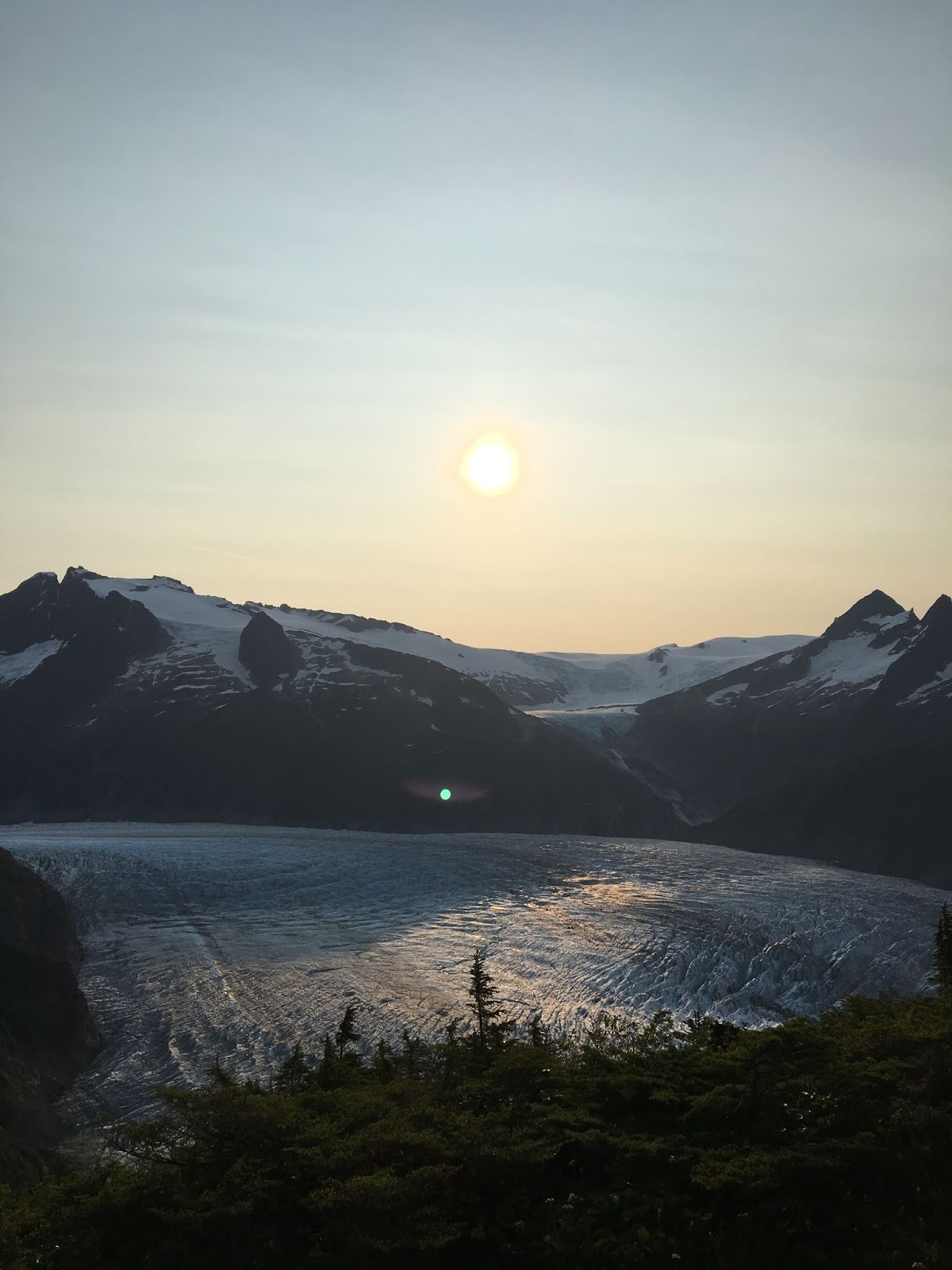
Sunrise.
In the morning, we woke up, had breakfast. And because of the steepness of the rise of the mountain and concerns about knees, two of us decided that we would hitch a ride down the mountain with Coastal and take the heavier bags with us. A friend came and picked the two of us up while the rest started down the mountain with our canine compatriot.
And apparently, because I can't figure out how to get a video from an app to here, I recorded the helicopter taking off and showing us how far we had to go. I muted it and put music over it, because no one needs to hear my commentary about how far we had to go and how we never would have made it with the amount of water we had, or how terrifyingly steep the backside of McGinnis Drops off.


So, for now, I haven't checked off the peak of McGinnis, but that's the thing about making your own rules. You get to break them without consequence. Next sunny weekend day - that isn't snowy - I'll try to hike to the top without all the extra gear, and keep it to a day trip.


